Noosa Botanical Gardens and Lake MacDonald

Poinsettia winter rose

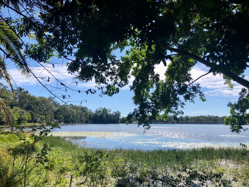
I’ve been struggling a tad of late. I’m behind in delivering my novel, and a few other bits and pieces are getting on top of me.

After giving myself a talking to I’m beginning to get on top of things again. What has also helped is that I’ve been forced to take a couple of days off – the last two Tuesdays – in the day job. It’s a reduced hours covid thing, but something that has occurred right at the right time for me. Last week it rained, but this week we packed some soup, sandwiches and a thermos of hot water for tea and off we went to explore Noosa Botanical Gardens at Lake MacDonald.

The first thing you need to know about this place is that it isn’t in Noosa. It is, in fact, just out of Cooroy in the Noosa Hinterland. The only other thing that’s worth knowing is that this place is beautiful.

In fact, it’s so beautiful that I’ll do a bit of showing rather than telling.

Note to self: come back in the summer when these poincianas will be a mass of red flowers.

If you want to know more about the gardens and its history, check out this link.

Advertisement

Buderim Forest Park and Serenity Falls


I’ve been bookmarking pictures of Buderim Falls (or “Serenity Falls”) since before we moved to the Coast. The pictures on instagram showed a lush rainforest with a relatively short (hello, I’ve seen the size of those falls in New Zealand…just saying) waterfall into a beautifully lit turquoise swimming hole. Of course I was keen to go!

There are two entry points to Buderim Forest Park – and two ways to get to the falls:

The lower entry is at Lindsay Road near Harry’s Restaurant. The track from here takes approximately an hour return – longer with stops. It’s boardwalk for approx 600m and then bush track. Apparently the track gets a tad “rugged” and the website says it’s not great for those with “walking difficulties or a low level of fitness.” I’ll try that way next time. There’s apparently barbecues and picnic facilities here.

I went with the entry closest to our house – the one at the base of Quorn Place. There’s  a good amount of parking here and well maintained barbecues and picnic tables for when you’ve finished the circuit.

The circuit track itself is quite short – less than a kilometre return. It begins with a relatively steep downward bush trail. My knees aren’t great  – and I’m petrified of being the big fat lady falling down the hill, so I took it quite slowly and it was absolutely fine.

About 100m down there’s a fork in the park. I took the option of heading through the open forest so went to the right, crossing a short bridge and walking through the edge of the forest. With the sound of the trees, the birds and the tinkling of the water below, it’s just beautiful in here. It’s also hard to believe that we’re pretty much in the middle of Buderim.

From here there’s another short and steep-ish downhill scramble to the bridge above the falls. Apparently the bridge was built offsite and lowered into place by a hovering helicopter. #funfact

You can walk down into the swimming hole and around behind the waterfall,but when I was there, there was a proper photographer with a proper kit set up down there – and ruining my photo (see the main shot below).

The falls themselves weren’t at full flow today – we haven’t had rain in a long time – but it’s still beautifully serene down there…get it? Serenity falls? Oh, never mind…

After a short piece of boardwalk, it’s all uphill from here to get back to the carpark. But it’s do-able, it’s only 300m (or so), and there’s a viewing platform part of the way up that you can catch your breath at.

Accessibility

The path from Quorn Close is not accessible for prams or wheelchairs.

Dog friendly?

Sorry, no, not this one. There are no dogs allowed in the forest park.

Toilets

Yes, at the entrance.

How hard is it?

It is quite steep downhill to start – which means it’s quite steep to come back up. You step down from rock to rock – so it can be very slippery after rain. The path itself is in pretty good condition. The steep parts are over and done with quickly and the distance is short so anyone with moderate fitness can do this one. Just take care after storms when there can be debris over the path as well. Don’t try this in thongs/ jandals/ flip-flops

Can you swim in the swimming hole?

People do – I’ve seen the evidence on instagram. Apparently the creek passes through suburbia and some stormwater drains to reach the falls, so…well, I’ll leave that to you.

Want to know more? 

Check out this page.


Coastal Pathway: Point Cartwright – Kawana

Followers of my instagram page know that I like me a good sunrise, but there’s something about seeing a sunrise from a lighthouse that feels like you’re really making an effort to see the sunrise, if you know what I mean.

It’s something I’ve been meaning to do for months – catch the sunrise from Point Cartwright. I’ve also been meaning to do the first leg of the Point Cartwright to Caloundra coastal pathway – just as far as Kawana, anyways. Plus, I’ve been wanting to try the breakfast at One on Balsa, so why not combine all three? Now that’s what I call multi-tasking.

Start and Finish…

We parked up near the lighthouse – mainly because the pathway starts at the Lighthouse, but also because it was still dark when we arrived. You could, however, park at Balsa Park and walk beside the river and then up to the Lighthouse – see this post for more information.

We waited for sunrise and then started walking.

Distance…

It’s just 3kms from the Lighthouse to Kawana Surf Club. From here you can keep walking – the path goes all the way to Caloundra. We turned around and retraced our steps for a total of 6kms.

The path…

The path is wide and paved the whole way – aside from some boardwalk near the lighthouse.

It’s fully accessible for prams and wheelchairs. The only obstacles are the early morning runners. Other than that, it’s a little up and down in a few places, but nothing steep. Besides, with this view, the steps just fade away.

Dog friendly?

On a leash, absolutely. There are also plenty of exits down to the beach, so check the signage at each if you intend letting el poocho off to run.


Toilets?

Yep, there are some at the Lighthouse, at Buddina Beach, and at Kawana near the Surf Club. There’s also a really well-equipped outdoor gym at the Surf Club.

Coffee and food?

I’m glad that you asked. We rewarded ourselves with breakfast at One on Balsa at Balsa Park. The outlook is fabulous – across the river to the yachts and the fisheries at Mooloolaba. This morning there was a group of intrepid over 60’s doing tai chi. You could almost touch the serenity.

But back to One on Balsa….

They have an extensive juice and smoothie menu, but we settled on a fresh orange juice and a restorative coffee.

As for breakfast, I chose the breakfast bruschetta – essentially an avo smash with bacon and fabulous tomatoes – and Miss 19 went for an acai bowl.

I have a theory that acai bowls were invented not for their super food status, but for instagram. These things are seriously pretty and it seems that half the cafes on the coast use them to hero their social media accounts. Anyways, Miss 19, who is a self-confessed expert on acai bowls, declared this a really good one. Apparently the difference was in the depth of banana, and the use of great rather than ordinary granola. Served in a bowl deeper than it looks in the pic, she said it was full of yummy surprises.

I’ll be back for some of the lunchtime salads – maybe when I do the next leg of the path…

Point Cartwright Headland

Most mornings – and at least a couple of afternoons a week – I walk around to the end of the rock wall at Mooloolaba. It’s a great walk – with one teeny weeny issue: you don’t really see the sunrise from here. Pt Cartwright is the place for that. I’ve heard it said that it’s the best place for the sunrise on the coast…I’ll test that theory some day.

It’s also the place for some incredible views. From up here you can see in all directions. Straight down the coast to Caloundra…

in the other direction, up the coast across to Mooloolaba and as far as Mt Coolum. That little lump on the horizon in the pic below is Mt Coolum.

Apparently this headland point is also a good spot to watch the whales as they migrate north (and south) each year. They’re due to come through over the next month as they head north to the Barrier Reef.

Of course there’s a lighthouse – which I didn’t take a picture of because it’s one of those modern lighthouses that really is nothing to look at.

The story of it is interesting though – if you’re into lighthouse history, that is. From the late 1800s, the Caloundra Lighthouse was the beacon that guided sailors safely down the coast. By the time they got to Caloundra, they knew that the port of Brisbane wasn’t that far away. The problem was that as Caloundra grew from a fishing town into a tourist town and high rises started to be built, the light from the Caloundra Lighthouse was competing with a lot of other lights for prominence. In 1978 a new lighthouse was built at Point Cartwright. An automated light, it’s never been manned.

Another thing to check out up here is the mural on the water reservoir.

It features the type of sea life that migrates through here – or that can be seen in the skies above and the waters below. From the rock wall at Mooloolaba it looks like a blue blob, but up close, it’s fabulous.

Getting there

We parked at La Balsa Park, Buddina, and walked around to the Headland, climbing the short track to the lighthouse. This path follows the Mooloolah River and looks across to fisheries at Mooloolaba and then the rock wall. In the shallows we watched an eagle (or was it a kite? I’ve never been great at the technicalities) washing himself, his partner flying back and forward to check on him.

From here you round the point to the Headland Beach. Again the views are fabulous, but it also feels as though you have the whole place to yourself – especially on a Friday afternoon in June.

From the beach you head through the pandanus, past the picnic area, to a fork in the path. One way is paved, the other is little bush track. Both lead you (after a short climb – about 100m or so) to the Lighthouse.

If you don’t feel like walking, there’s a carpark at the end of Pacific Boulevard.

Dog friendly?

Yes. Check out the signs for when (and where) you can have your pooch off the leash…and don’t forget to take a plastic bag with you to pick up after them.

Difficulty and accessibility?

Easy. This little walk is flat and paved the whole way – with exception of the last 100m or so to the Lighthouse – it’s paved, but not flat.

There are plenty of places to sit and check out the view – both along the path and up at the Lighthouse.


Mooloolaba to Cotton Tree Coast Walk

Cotton Tree

With paths available all up and down the coast, covering a little extra distance than usual was also not difficult. Like this one: the coastal path from Mooloolaba to Cotton Tree. I started at sunrise and was back at the surf club at Mooloolaba for morning coffee with hubby.

How far?

I started the walk down near The Spit, so it was just over 10kms return. from the Esplanade it’s 4.4kms each way.


How hard?

Aside from the headland between Alex and Mooloolaba, this is a flat, very easy walk.

Why do it?

For the scenery. On a nice day, the beaches are fabulous- and on a moody Monday morning in the middle of winter, it can feel like you have them to yourself.

Coffee?

Absolutely- each of the surf clubs has a coffee cart or kiosk. Plus there are plenty of little places like this one that you walk past.

Toilets?

Available at each surf club.

Accessibility?

The path is wide and paved the whole way- making it accessible for wheelchairs and prams.

Dogs?

Leashed only. Don’t forget to pick a plastic bag up from the dispensers along the way…

Want more?

Each Sunday the main street in Cotton Tree is closed to traffic and a well worth a look at market moves in.

Alternatively, why not break your walk at the halfway point and stop for breakfast? Cotton Tree has plenty of great coffee shops to choose from.

Cotton Tree